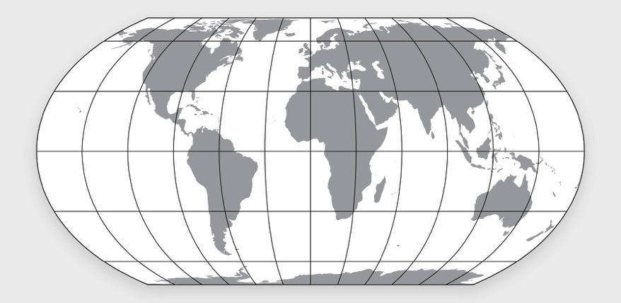
Equal Earth projection
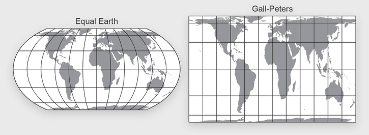
The Equal Earth map projection is a new equal-area pseudocylindrical projection for world maps jointly developed by Bojan Šavrič (Esri), Tom Patterson (US National Park Service), and Bernhard Jenny (Monash University). It was created to provide a visually pleasing alternative to the Gall-Peters projection, which some schools and socially concerned groups have adopted out of concern for fairness. Their priority is to show developing countries in the tropics and developed countries in the north with correctly proportioned sizes.
In addition to being rigorously equal-area throughout, other Equal Earth projection features include:
• An overall shape similar to that of the Robinson projection. (The Robinson, although popular and pleasing to the eye, is not equal-area as is the Equal Earth projection).
• The curved sides of the projection suggest the spherical form of Earth.
• Straight parallels that make it easier to compare how far north or south places are from the equator.

The Equal Earth and Gall-Peters projections compared. Continent shapes are more recognizable on the Equal Earth projection.
The overall shape of Equal Earth is similar to the non equal-area Robinson projection.

North & south, all places are correctly sized
Learn more
For specifics about the design and development of the Equal Earth projection refer to this August 7, 2018, article published in the International Journal of Geographical Information Science.
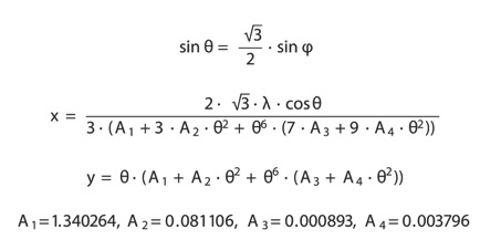
Software developers: you can implement the Equal Earth projection by downloading the JavaScript code here. Equal Earth is also available in PROJ and JMapProjLib.


Math magic. The equation for the Equal Earth projection developed by Bojan Šavrič.